
T.E. Lawrence (i.e. Lawrence of Arabia) once commented that “the printing press is the greatest weapon in the armory of the modern commander.” This was as true in the 15th century, following the introduction of the printing press to Western Europe, as it would be during the Arab Revolt of 1916. During the Renaissance, the impact of the printing press could be seen not only in the widespread dissemination of texts such as the Bible, but also in visualizations of the world through maps. The printing press allowed individuals access to maps on new, unprecedented levels and illustrated the topography of Christendom for the masses.

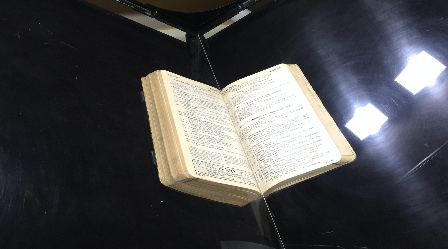
I was reminded of the power of the printed map on a recent trip to the Newberry Library in Chicago. When we got there, Jennifer Wolfe, the Newberry’s Digital Initiatives Librarian, and James Akerman, Director of the Hermon Dunlap Smith Center for the History of Cartography and Curator of Maps, took the time to walk us over to the special collections vault. Thousands of maps reside in the Newberry’s collection, which you can search online. They include both hand drawn manuscripts like Dati’s Sfera (written in part as a geographical textbook for the children of Florentine merchants before 1435), and printed atlases such as Abraham Ortelius’ Theatrum orbis terrarum (1570).

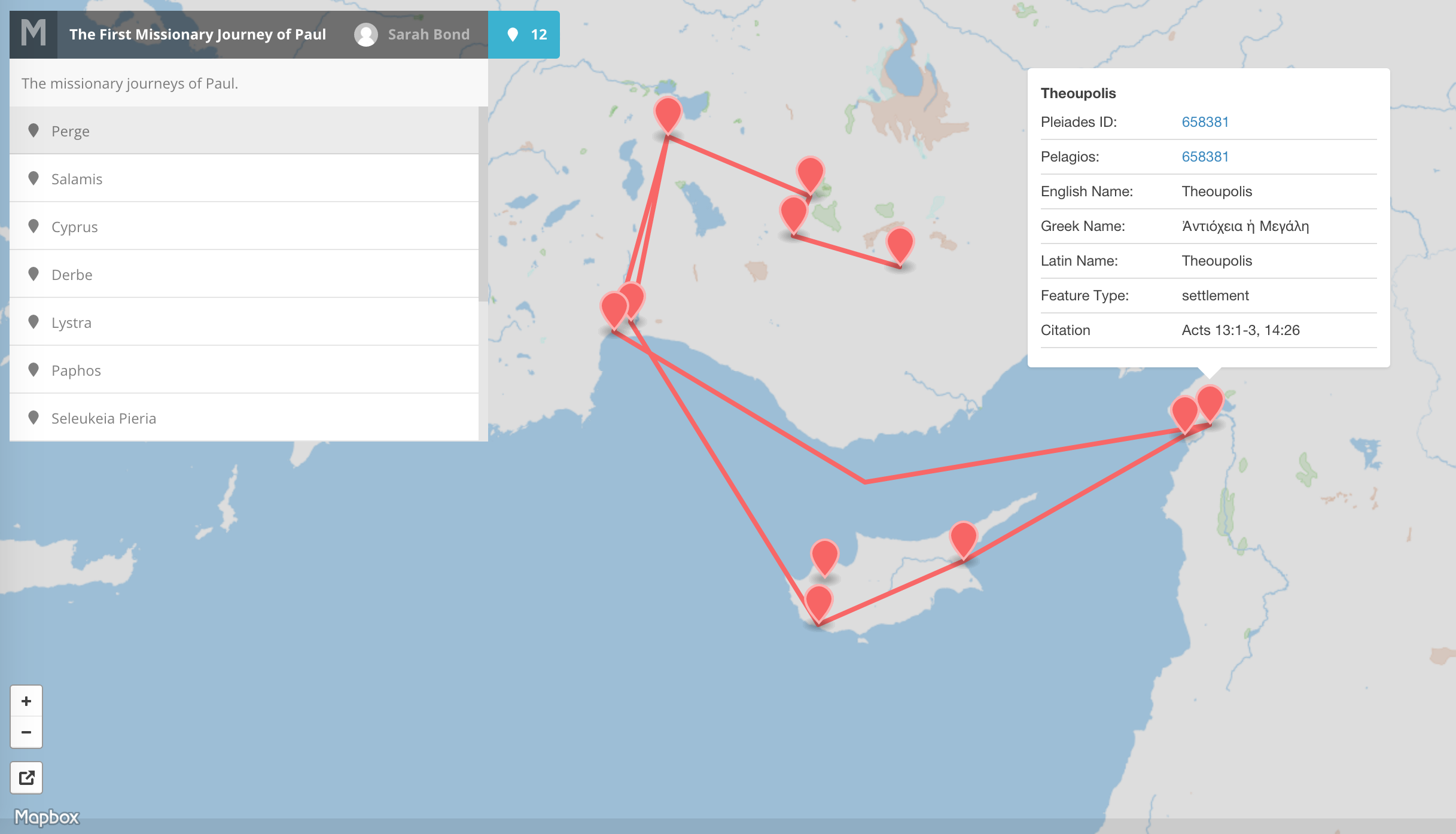
One of the Newberry’s editions of Ortelius’ Parergon captured my attention immediately. The Flemish cartographer had been part of the early modern geographic movement’s jet set in the 16th century. His 1570 publication is considered the first modern atlas. It included a number of subjects, such as the journeys of Paul–the Peregrinationis divi Pauli–which were of interest to both Catholics and Protestants.

My eye was drawn not only to the destinations visited by Saint Paul, but also to the famed sea monsters depicted in the map. Today, the study of maps with sea monsters seems to have become all the rage. This is due in large part to the publication of Chet Van Duzer’s seminal “Sea Monsters on Medieval and Renaissance Maps” (2013), which documents the creatures drawn on medieval maps from the 10th century through the 17th century. While cartographers used these beasts to indicate mysterious areas and the dangers of the sea, they here appear to be used by Ortelius not only to delight the reader, but also to indicate the possible hardships of St. Paul’s many missionary journeys.

The travails of Saint Paul was also a popular subject in early printed Bibles. A recent survey of 1000 printed 16th century Bibles found that 176 of them in fact included maps. Much like today, people enjoyed having pictures in their books in order to visualize the words that they read. Modern scholarship focused on early modern cartographers has found that many imbued their maps with religious symbolism. However, modern historians Catherine Delano-Smith and Morley Ingram discovered that these maps were not generally found within the Bibles printed in Catholic countries like Italy, Portugal, and Spain. As such, they argue that “the history of maps in Bibles is part of the history of the Reformation” (1991: XVI). Protestants were predominantly the ones who used the power of the map to their advantage within their printed Bibles, though atlases such as Ortelius’ often transmitted ecclesiastically themed maps. Protestants in particular emphasized the need to marry the word of God with cosmography.

In the seminal Geneva Bible printed in 1560, there were 5 maps included. It was a hugely popular English edition used by Shakespeare and many others, with maps depicting Eden, Exodus, the Holy Land, Canaan, and the Journeys of Paul. As Justine Walden notes, these maps were there “to assist readers visualizing difficult scriptural passages” (2012: 187). Much like the age of digital visualization we are now experiencing, people processed text and data more easily with the aid of a map. Reading the book of Acts, which records the various places Paul visited, was likely enhanced by the inclusion of a map of the places mentioned in the text.

(Carefully) Touching the atlases in the Newberry Library was a great reminder that texts and images must be considered together when they are interpreted. Just like archaeological objects which are sometimes taken out of context and presented within the vacuum of a museum or an online database, maps should not be ripped out and evaluated as a singular page divorced from all context. Even in digital form, they remain a part of a whole.
If they are included within a book, a folio, or a codex of some sort, the overall aims and purposes of these tomes influenced the way the reader experienced the map in the 16th or any other century. Consequently, they are a part of the historical reconstruction of reading the text. This is an important caveat for those using Google image search or simply browsing newly digitized texts for academic publications.
Just like material objects, maps can also have underlying messages. As the West Wing taught us, even the 1569 Mercator Map–another relic of the early modern cartography craze–transmits a message of Western imperialism via its skewed scale. The wise T.E. Lawrence was right: the printing press is the greatest weapon in the armory of any modern commander, but I would add that maps are often rather silent ammunition.
Many thanks must be given to James Akerman and Jennifer Wolfe at the Newberry Library, and to Rob Shepard, GIS Librarian at the University of Iowa.

Leave a comment