As I drove from Milwaukee to Iowa City last year, I thought about the digital humanists at the University of Iowa and the diversity of their work. Though the richness of the digital interfaces for the projects had drawn me in, it was their scope – the methodologies, the content, the geographic focus – that gripped me. The digital humanities at Iowa ranged in approach from GIS to 3D modeling, in subject from Shakespeare to Walt Whitman, and in provenance from Petra to St. Louis. I was seduced by the chance to change the canon and intrigued by the unknown depth of the possible.
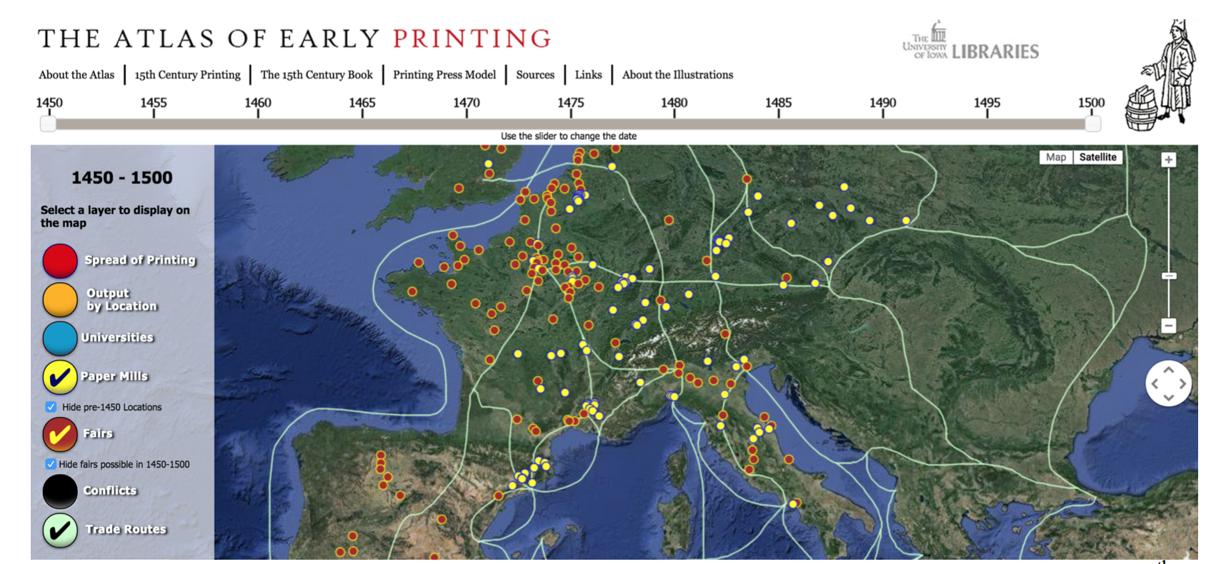
Screenshot from the Atlas of Early Printing, which maps early printing in Western Europe during the 15th century.
*Record Scratch* Okay, hold up a second. As per usual, we can’t just throw around the terms “digital humanities” and “digital humanist” without a little self-reflection. I was recently reminded of this fact in an oral defense for a PhD candidate, when the question was asked yet again: “What is the digital humanities?” The head of the dissertation committee wanted to know. As it turned out, every individual in the room—six of us in total—had a slightly different definition. This multiplicity, in my experience, is the norm. It must be said that the candidate modified the famous Potter Stewart definition of obscenity by noting that, well, we know digital humanities when we see it. A fair point!
Why this definitional disconnect? As I once heard a theoretical physicist explain when asked about the limits of the universe: it is difficult to define because even defining it means that there is a tangible, finite shape. A few years back, Rafael Alvarado implored us to be frank about this issue “Let’s be honest—there is no definition of digital humanities, if by definition we mean a consistent set of theoretical concerns and research methods that might be aligned with a given discipline…” In lieu of a singular definition, we have adopted an array of methodologies and outlooks that we have collectively termed “digital humanities.” Digital humanists, much like the Renaissance humanists of the fourteenth to sixteenth centuries, cannot be described monolithically or encapsulated with an easy definition. Like our humanist predecessors, we too care about people, preservation, and new approaches to old problems. And these approaches take a digital form and often rely on digital technology to aid us in revealing patterns or providing access.
With this wideranging definition in mind, we can now address the spatial humanities—a subfield of DH. The spatial humanities often use geographic information systems (GIS) to analyze, visualize, and interpret data. As someone who focuses on GIS and mapping in her own work, I thought that for this year’s Day of Digital Humanities, I would try and visualize the richness of the digital projects here at Iowa through the medium I know best: maps. Click here and you can begin to explore a map of the various digital projects based at the University of Iowa.
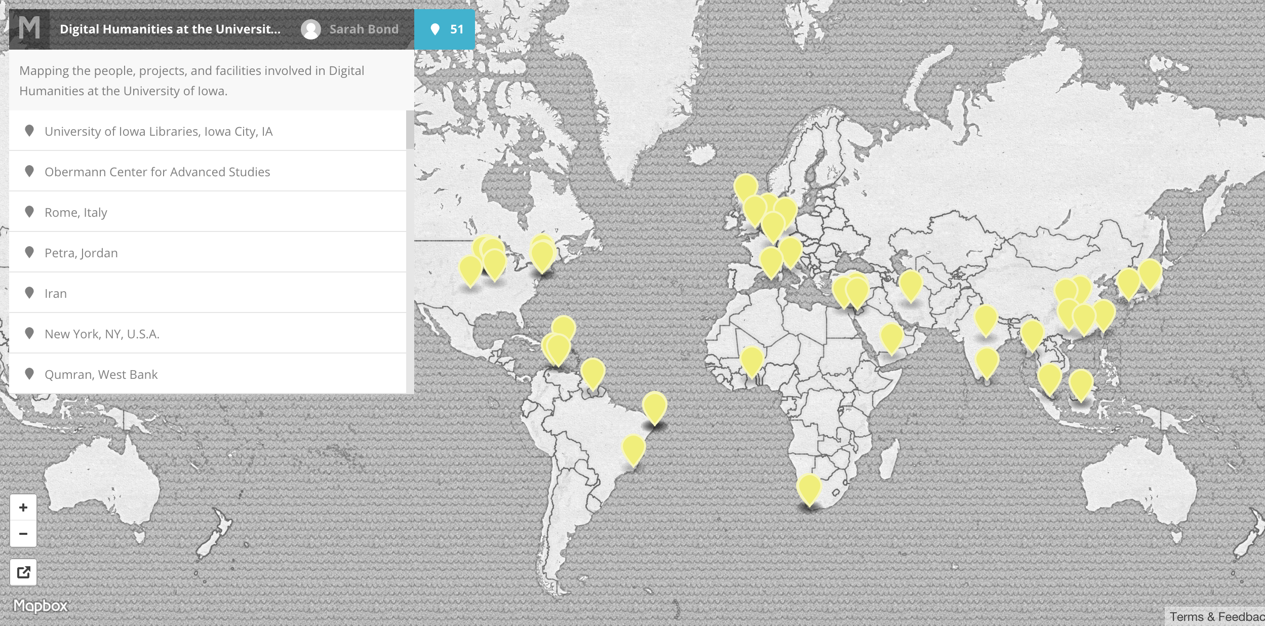
Take a click and explore the various projects engaged in by digital humanists at the University of Iowa.
As the map indicates, many of the projects focus geographically on Iowa herself. For example, DIY History uses content pulled from the Iowa Digital Library and selections from the University of Iowa Libraries’ Special Collections, University Archives, and Iowa Women’s Archives. The project promotes interactivity with readers and allows them to contribute by transcribing various documents. It is powered by Omeka 2, although the custom theme and transcription plugin were created by the Digital Research & Publishing department at the University of Iowa Libraries.
Other projects approach urban space in new and innovative ways. Historian Colin Gordon’s “Mapping Decline” site, a digital supplement to his book, Mapping Decline: St. Louis and the Fate of the American City, presents telling maps of St. Louis in the 20th century that explore the topics of white flight, race and property, municipal zoning, and urban renewal. Thousands of miles away, classicist Bob Cargill is at work on the “Digi-Tel Azekah” Digital Reconstruction Project. The project aims to reconstruct the archaeological remains of Tel Azekah in Israel. It uses 3D models and diachronically documents and maps all the strata of the buildings on the site. Below, you can see a model done by Cale Staley, a recent M.A. graduate from the UI Religious Studies department, who works in Digital Humanities research. Like Cargill, he digs at Tel Azekah in Israel and contributes to Iowa’s archaeological model of the site. And Staley is just one example. The University of Iowa doesn’t simply facilitate DH research among its faculty, it trains new digital humanists to enter the field.
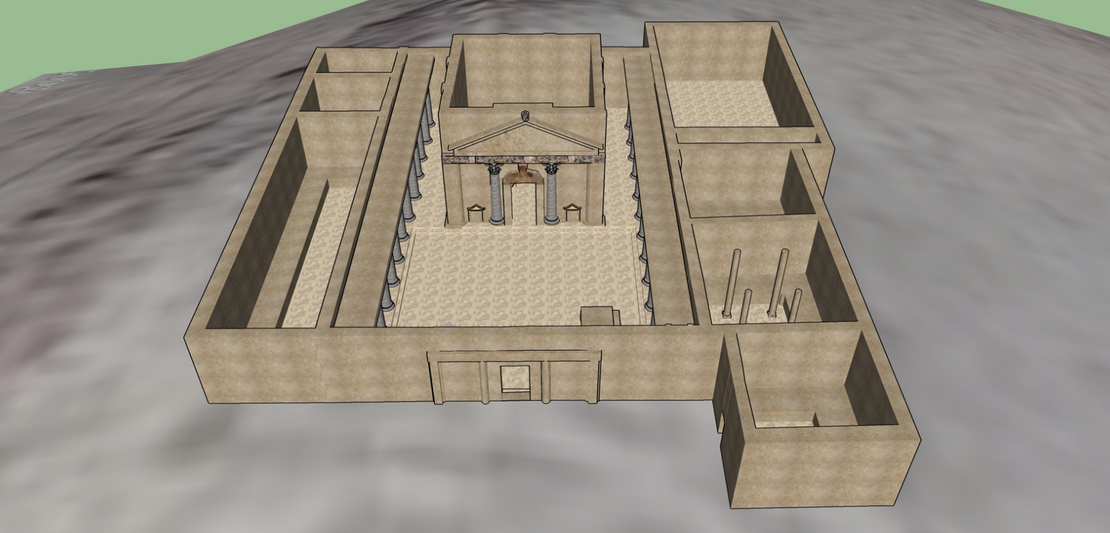
Staley’s model of the Nabataean temple at Khirbet et-Tannur, located in Wadi Hasa atop Jebel Tannur.
Not all projects focus on space at a city level. Art historian Julie Hochstrasser’s project on seventeenth century Dutch traders, “The Dutch in the World,” visualizes global interculturation, defined as “the circulation of motifs, techniques, ideas, and images across cultures and through time.” As Hochstrasser notes, this process has been happening for a long time; however, “specializations in art historical scholarship have slowed the kind of integrated cross-cultural comparison required to apprehend these complex processes of exchange.” The project breaks out of the traditional Eurocentric model in order to see broader patterns of interchange. Alternately, another art historian, Björn Anderson, contributes to the “Levantine Ceramics Project,” which brings together archaeologists working in the Levant in order to build a database that cites and maps ceramics in the region from 5500 BCE to 1920 CE.
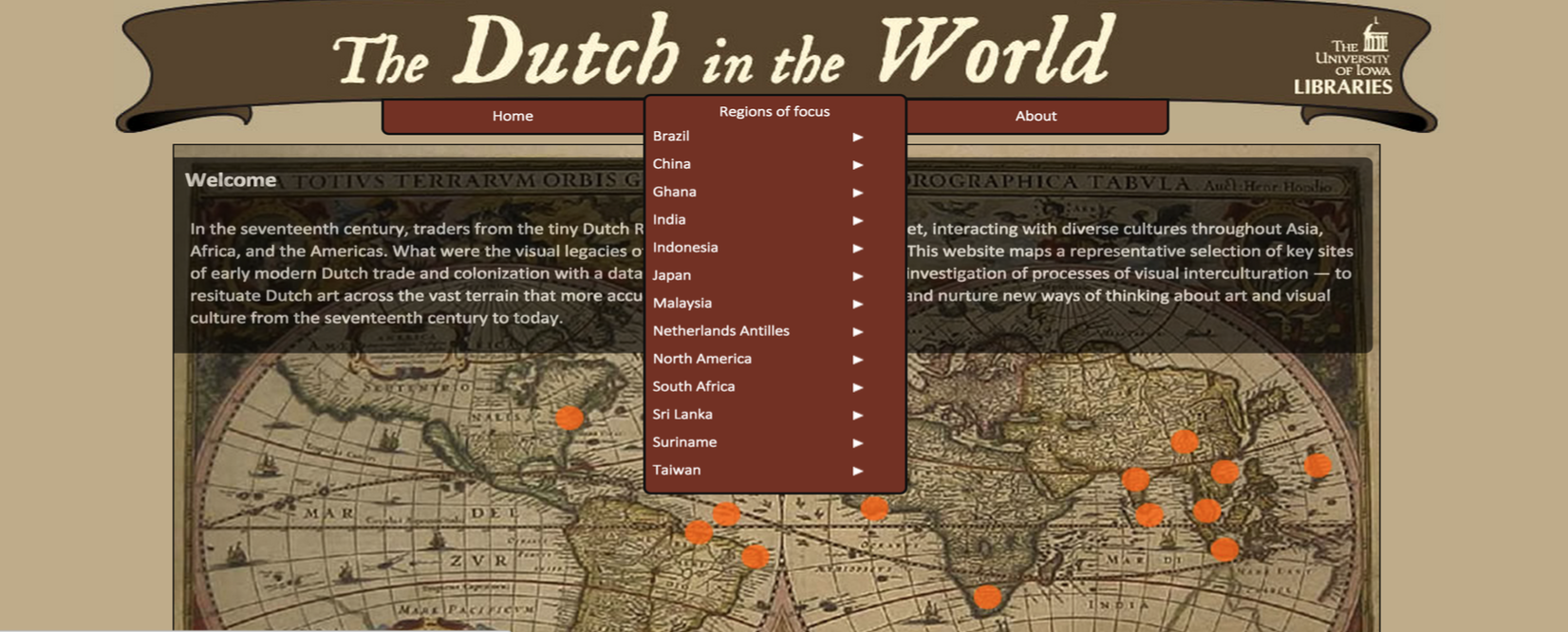
Interface for “The Dutch in the World” project, which maps and explores a number of contact sites involved with Dutch trade, colonization, and artistic exchange.
Still other projects use space to map and visualize networks, nodes, and patterns of circulation for print materials. Blaine Greteman (English), David Eichmann (School of Library and Information Science), and Charisse Madlock-Brown (Health Informatics), for instance, head up the “Shakeosphere,” a digital research and teaching tool that “allows users to search, analyze, and contribute to a visualization of the early modern print and manuscript network.” Additionally, the “Atlas of Early Printing,” maps early printing in Western Europe during the 15th century, following the invention of the printing press. It is the creation of Greg Prickman (Head of Special Collections & University Archives), but was coded by Andrew Holland, Web Application Developer for the University of Iowa Libraries.
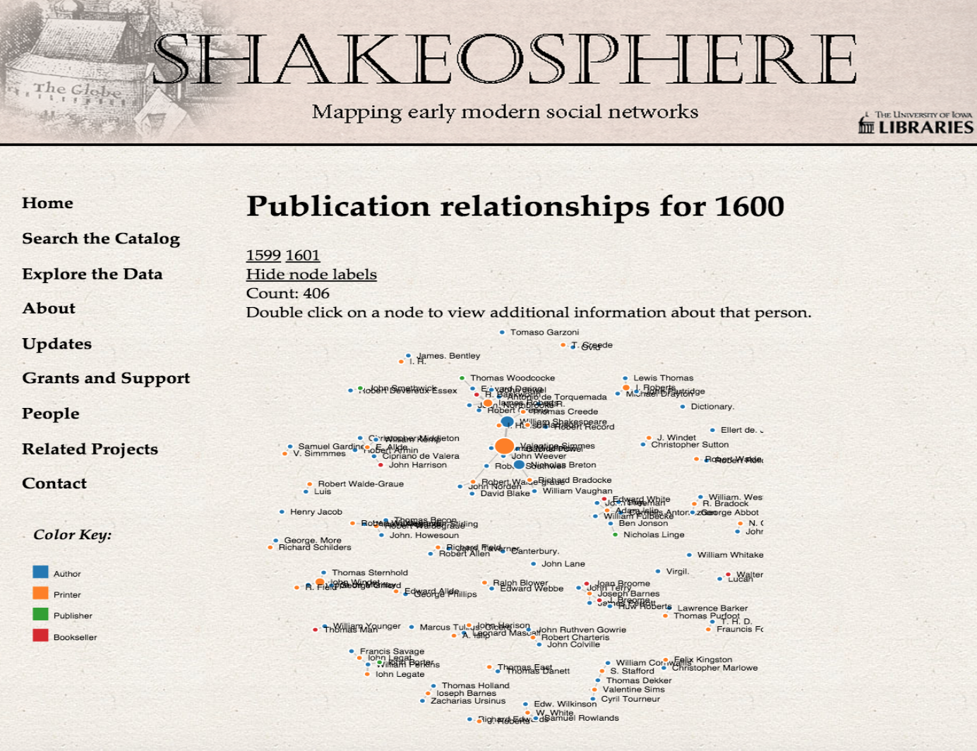
Node of early modern publication relationships for 1600 CE visualized by “Shakeosphere.”
As these spatial humanities projects show us, DH at the University of Iowa spans departments, disciplines, and skill levels. Whatever definition one uses, the defining characteristic of DH is that no scholar is an island; the digital humanities foster interdisciplinary work. Librarians, developers, coders, GIS specialists, graphic designers, and many other people support and enhance the ideas of humanists across campus. The projects I have explored here are just a smattering of the digital humanities projects currently in existence or underway. What’s coming in the spatial humanities here will be equally exciting—and I say that not just because my Co-PIs Paul Dilley (Religious Studies, Classics) and Ryan Horne (History, UNC-Chapel Hill) are currently working on geospatial and network analysis tools for ancient texts. It is clear not only to me, but also to many of us here at Iowa that space is the final frontier. After all, Captain Kirk will be from Riverside, Iowa.

Leave a comment